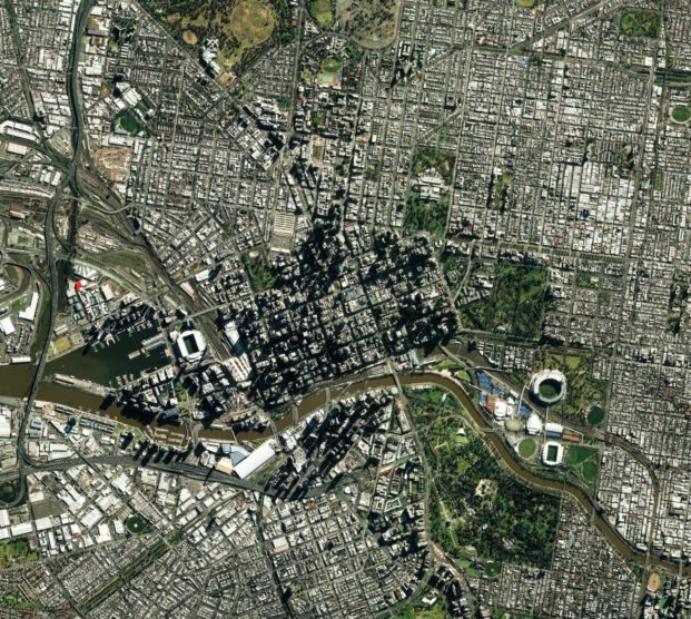
What is earth observation data?
Earth observation data is coming from optical, radar and thermal images from satellites about physical, chemical, biological systems of our planet. Optical and thermal sensors are monitoring the energy received from the Earth due to the reflection and re-emission of the Sun’s energy by the Earth’s surface or atmosphere and operate in between the visible and infrared wavelengths of the electromagnetic spectrum. The observations are limited to cloud conditions. Radar sensors operate in longer wavelengths and most of the sensors send energy to Earth and monitor the energy received back from the Earth’s surface or atmosphere. The observations can be acquired in all-weather conditions.
Satellite data can help user to understand the global picture & trend as well as development of area under interest in multiple data dimensions. Historic data can be used to build models to predict the future state and illuminate future development trends.
Earth Observation data recency:
Satellite data recency usually vary from 6 hours to couple of days old. While special data resolution for landcover can be from 10 meters to 50 cm.
Public satellites from Copernicus program launched by European Space Agency offer 10 meters resolution. Copernicus satellites – the most ambitious space observation program to date. Copernicus sentinels monitor land, marine, atmosphere, climate change and emergencies data close to real time and provide the information of the health of our planet.
Proprietary satellites like Pleiades from Airbus offers 50 cm resolution. The performance will be enhancing by 2020. In 2020 Pleiades Neo will allow new optical resolution of 30 cm. This will allow earth monitoring and change detection with a new unseen level of accuracy.
Which information we can extract from satellite data?
From satellite imagery we can extract historic and close to real time data, information, knowledge and detect recent changes about land, marine, atmosphere, climate, security state of areas of interest of our planet. Using historic satellite imagery data, we can monitor the current state of the planet and forecast the future.
Earth observation data applications: below one can find couple of many use cases of bringing value out of earth observation data in various industries:
Earth observation data has various of applications in many businesses from urban planning, insurance, forestry to energy, etc. Here are some possible use cases:
Urban development:
- Land usage/green spaces occupancy of city development over time
- Land cover inventories on urban fabric, construction sites
- Satellite imagery could support traffic management systems in increasing the level of road safety in urban areas by providing additional data on areas and road segments that are at risk for both road users and pedestrians
- Urban heat islands monitoring (heat islands occur when air temperature is higher than in surrounding rural city areas due to high building density, absence of green spaces, pollutions and accumulation of anthropogenic heat)
- Change detection algorithms applied to a satellite data image can help to detect changes had happed in an urban area over a certain time.
Forestry:
- Monitoring illegal logging to access the compliance of the forest owners to the law
- Monitor forest fires and locate areas where natural disasters are. Provide optimal routing to the incident.
- Evaluating land productivity for forest types given biophysical and climatic factors
- Access the changes in resources over time
Marine:
- Mapping of fishing zones
- Forecasting algal blooms
- Better forecasting of new areas accessible due to ice melting
- Water depth, winds, waves and current monitoring for renewable energies and ship routing
- Forecasts of regional sea level rising and storm surges
- Monitoring and prevention of coastal erosion
- Supporting environmental regulations and Marine Protected Areas
Monitoring renewable energy
- Selection of optimal location for renewable energy: Determine the optimal locations of energy facilities, considering the wind rose, solar illumination, terrain, land surface temperature, etc. and the conditions of insolation.
- Create a model to Forecast the energy production and irradiance using historic EO data as well as weather conditions for a solar panel.
- Environment monitoring
- Tracing biomass and monitoring production
- Energy trading
- Help to make a new investment decision: Investment decisions to deploy additional energy infrastructure and to develop new energy resources must consider potential future weather, water and climate conditions over multiple decades
Insurance for natural disasters:
- Detect the extended damage of a natural disaster such as flooding, hurricane, tornado.
- Forecast Floods, fire risks
- Flood alerts (EFAS), including early warning
- Analysis of historical data of similar events
Agriculture:
- Detect crops health/disease and contaminated areas
- Detect crop grows progress and the need of watering
- Detect farmers compliance with policy
Information source: Copernicus market report February 2019

